Saturday Jun 20, 2026
Saturday Jun 20, 2026
Tuesday, 6 January 2026 00:00 - - {{hitsCtrl.values.hits}}
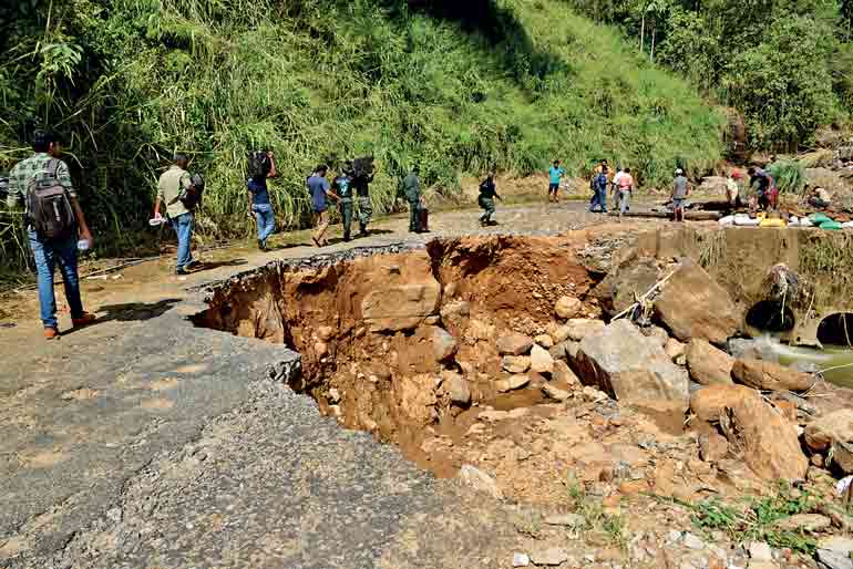
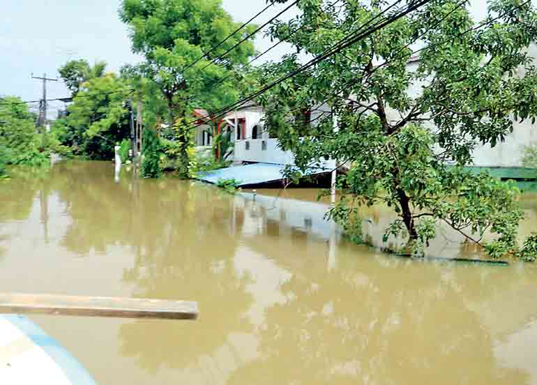
 When floods and landslides strike Sri Lanka, the public conversation almost always turns to nature. Heavy rain, deforestation, hill cutting, and river encroachment are cited as the culprits. These factors are real and serious: forest loss accelerates runoff, altered slopes destabilise terrain, and encroached floodplains erase natural buffers. None of this can be denied. Yet environmental degradation alone does not explain why disasters repeatedly unfold with late warnings, confused responses, and post-event blame.
The deeper problem is architectural. Not architecture in the sense of buildings or dams, but the governance and control systems that translate environmental signals such as rainfall, river levels, reservoir storage, slope saturation into timely, enforceable public action. Environmental damage increases the load on this system. The absence of an integrated hazard management architecture is what allows that load to become a catastrophe.
Each major flood exposes a persistent gap in Sri Lanka’s disaster management framework. Public debate quickly narrows to familiar, technical-sounding questions: Were reservoir gates opened too quickly? Were warnings issued on time? Was the rainfall truly unprecedented?
While these questions appear precise, they are largely distractions. They reduce what is fundamentally a national-scale systems failure into a sequence of isolated operational errors. This framing obscures the deeper issue: the absence of a coherent governance mechanism capable of integrating environmental realities into enforceable, state-wide decisions.
From an engineering perspective, Sri Lanka’s challenge is not rooted in a lack of awareness, expertise, or concern. Rather, it lies in the absence of an executable hazard governance operating system, one that can systematically connect data, forecasts, and risk assessments to binding actions across institutions. Without such a system, responses remain fragmented, reactive, and vulnerable to repetition of the same failures with each new flood.
Hazards are control problems, not media events
In modern risk management, floods and landslides are not anomalies. They are evolving input signals. Rainfall intensity, spatial distribution, and duration feed into catchment response. Catchment response feeds into river stages and reservoir inflows. These, in turn, determine when roads must close, when reservoirs must release water, and when people must evacuate.
The minimum control loop is well understood. Rainfall estimates feed runoff models, which generate inflow hydrographs. Reservoir routing produces downstream river stage projections. These are translated into inundation maps, warning triggers, compulsory orders, and enforcement.
Sri Lanka has fragments of this chain scattered across agencies. One monitors rainfall, another operates reservoirs, another issues landslide warnings, other requests evacuations. What it lacks is integration. However, these components are not fused into a single real-time decision system. Forecasts do not automatically become orders.
When this control loop is broken, the state relies on “early warning” in the form of sirens, media announcements, and generic alerts. These are communication tools, not operational controls. A true warning is precise: it states that at a specific time and place, water will exceed a defined level, and evacuation is mandatory. Without stage-based, location-specific projections, warnings cannot be trusted or enforced.
Reservoir debates expose structural failure
The architectural gap is most visible in debates over reservoirs. After every major flood, arguments erupt: did a dam cause downstream inundation? Victims describe sudden water rises, engineers cite storage volumes, politicians demand accountability. The public expects a clear answer.
But without calibrated reservoir–river flood models, no one can answer the only question that matters: what downstream river stages were expected, at what times, from each release decision, under prevailing rainfall?
Victim testimony shows impact, not causation. Simplified arithmetic produces numbers, not hydrographs. Without real-time inflow data, routing models, and downstream stage discharge relationships, it is technically impossible to isolate reservoir releases effects from cyclone rainfall, uncontrolled tributary inflows, floodplain storage, and channel constraints.
This is why the debate never ends. Sri Lanka is arguing causality without the scientific and institutional machinery required to calculate it.
The Hill Country: A coupled hazard system
Sri Lanka’s hill country is not merely landslide-prone. It is a coupled hazard system. The same rainfall event can saturate slopes, trigger landslides, fill reservoirs, and flood downstream cities. Droughts can even prime landscapes for violent flash floods by degrading soil structure and drainage capacity. Climate volatility has tightened these linkages.
Yet governance remains fragmented. Landslides, floods, and reservoir operations are treated as separate problems, managed by separate institutions under separate laws. The hazard cascade moves as one system. The state does not.
Planning without execution
Sri Lanka’s spatial plans increasingly point in the right direction. They favour densification along transport corridors, protection of environmentally sensitive zones, reduced expansion into unstable terrain. This is sensible. Scattered settlement across hills and floodplains is economically and administratively unsustainable.
However, densification alone does not equal safety. Concentrating people in flood exposed areas without calibrated models, enforceable zoning, and evacuation control simply concentrates risk. A spatial plan without operational science is aspiration, not protection. A spatial map is intent. Safety requires a system that can execute that intent under stress.
What reform requires
Real reform is architectural, not rhetorical. At minimum, Sri Lanka needs:
This is not theoretical. Countries such as New Zealand and Australia recalibrate models after major floods, publish updated maps, and hard-wire lessons into operational rules. They do not rely on post-event narratives.
Sri Lanka’s disasters are not proof of nature’s cruelty. They reveal a governance system unable to process environmental stress. Deforestation, hill cutting, and river encroachment intensify hazards. Architecture determines whether that intensity becomes a manageable emergency or a national tragedy. Until Sri Lanka builds a hazard governance operating system capable of converting environmental intelligence into compulsory, timely action, every major storm will end the same way: suffering on the ground, arguments in public, and lessons deferred to the next disaster
The real lesson
Sri Lanka’s disasters are not proof of nature’s cruelty. They reveal a governance system unable to process environmental stress. Deforestation, hill cutting, and river encroachment intensify hazards. Architecture determines whether that intensity becomes a manageable emergency or a national tragedy.
Until Sri Lanka builds a hazard governance operating system capable of converting environmental intelligence into compulsory, timely action, every major storm will end the same way: suffering on the ground, arguments in public, and lessons deferred to the next disaster.
(The author is a New Zealand–based Electrical Engineer with a Bachelor of Engineering in Electrical and Electronics and over 10 years of experience delivering electrical services within the dairy and meat processing sectors. She specialises in LV–MV power systems design, building services project delivery, construction monitoring, and site inspections. Currently, she works at the electrical–geotechnical interface, focusing on how ground conditions, terrain, and spatial factors influence medium-voltage power distribution, grounding systems, and overall electrical performance. She can be contacted at [email protected])


