Sunday Jul 19, 2026
Sunday Jul 19, 2026
Friday, 26 June 2015 01:31 - - {{hitsCtrl.values.hits}}
The Central Environment Authority (CEA) of Sri Lanka is an important user of ArcGIS technology and also mostly the local environmental ecosystem-based maps are prepared by the CEA. Furthermore to the valuable services of the CEA, they ensure the country’s environment related ecosystems and its resources are well preserved for the future generations.
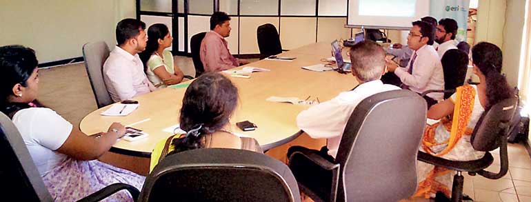
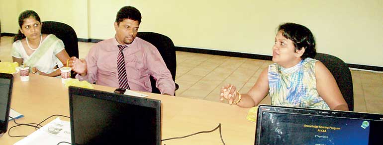
GIS Solutions Ltd., appointed by the global GIS Technology leader ESRI (Environmental Systems Research Institute – USA), recently conducted a workshop for the management team of the CEA on how to use ArcGIS Pro. This newest upgrade for the in-built application on the ArcGIS Platform is designed to assist Geographical Information Systems (GIS) professionals or mapping professionals to complete their projects and share their results faster and easier than before.
GIS Solutions Ltd., a subsidiary of Just In Time Group, is the local sole authorised specialist and distributor for ArcGIS platform and ArcGIS Pro application.
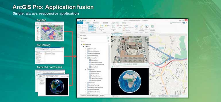
ArcGIS Pro is the newest application built on 64 Bit architecture with ArcGIS 10.3 for Desktop, designed to help GIS professionals complete their projects, share their results faster and easier than before. Nearly all of the maps in Sri Lanka are created on the ArGIS platform through which ArcGIS Pro can be used efficiently to complete diverse tasks related to; mapping, editing, geo-processing, and analysis.
The modern ribbon interface and tailored integration of 2D and 3D capabilities within ArcGIS Pro will now streamline the way the user operates GIS work. This is a simplified version with an integrated (ArcMap, ArcCatalog, ArcScene and ArcGlobe) interface on ArcGIS Online. Now, the user has the capability to share 2D and 3D data owed to synergy of the interfaces; geo-designing experience, multiple map layout capacities, simple search and query facilities and easy customisation.
This workshop was aimed at enabling the CEA staff to enhance their development of maps (location based data) and more information of GIS Solutions’ offerings. The CEA will be able to utilise the benefits of ArcGIS Pro in their research and planning works more efficiently through this upgraded interface, enabling them to discover, use, make, and share maps from any device and online.
The powerful advantage of the 2D and 3D maps in one user interface makes it faster than the existing version of ArcGIS which adds on to the existing benefits. This session was for a 12-member audience from the CEA Research & Development and Management teams for this new technology update.
GIS Solutions CEO Ashani Jayasinghe stated: “GIS is much more than a tool to draw maps. It’s a decision making support and inter-department collaborative tool that will assist organisations in furthering information accurately. This year GIS Solutions’ drive is to ensure our users are trained to maximise the use of ArcGIS Software – the world leading platform and are here to support them. ESRI’s founder Jack Dangermond is also an environmentalist, thus ESRI and its international distributors like us are committed to supporting organisations such as CEA to better manage the natural resources and the environment for our future generations. A key objective this year for GIS Solutions is to introduce the new capabilities of ArcGIS Platform to all our stakeholders.”

