Sunday Jun 14, 2026
Sunday Jun 14, 2026
Monday, 24 April 2017 00:02 - - {{hitsCtrl.values.hits}}
 With the adoption of the Sustainable Development Goals (SDGs) in September 2015 and the new agreement on climate change at COP21 in Paris, Sri Lanka received a much-needed push towards implementing its ambitious forest-centric development agenda.
With the vision of “Forests and beyond, sustaining life and livelihoods in a greener Sri Lanka”, the Sri Lanka UN-REDD Program, which is the United Nations’ collaborative initiative on Reducing Emissions from Deforestation and forest Degradation (REDD+) in developing countries, supported the Forest Department to launch the country’s National Forest Monitoring System at Waters Edge Hotel recently.
Joining hands with the Forest Department of Sri Lanka, was the Department of Wildlife Conservation, Survey Department, Climate Change Secretariat, Central Environment Authority and the Natural Resource Management Centre. Each of these government institutions have been a part of the National Task Force formed to serve and offer technical advice and expertise on the development of this portal.
This online geo-portal containing forest-related data storage, analysis, and information dissemination, was launched with the aim of helping to decrease the threat to forests and to ensure permanence in preserving the forests in the country.
It has three major components that includes: the Satellite Land Monitoring Systems, which collects and assesses activity data (over time) related to forest land; the National Forest Inventory (NFI), which holds information relevant for estimating emissions, emissions factors such as forest carbon stocks and forest carbon stock changes, among other; and the Greenhouse Gas Inventory data.
Currently, the geo-portal also comprises of base maps, country boundaries, provinces, districts and DS Divisions, forest assistant divisions, forest masks and maps, NFI plots and grids, land use and land cover data, satellite imagery, agroecological regions, soil maps, protected areas that include wildlife areas, world heritage sites, environmental protection areas, conservation forest areas and forest reserves, terrain and water bodies such as river basins, rain gauge stations, and reservoirs under construction.
The data and information provided will be transparent, consistent over time, and suitable for measuring, reporting and verifying, taking into account national capabilities and capacities.
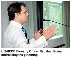
The launch event covered an introduction to the project, its progress and implementation, discussions on the way forward and future plans. Speakers at the launch included Udaya Senevirathne Secretary for the Ministry of Mahaweli Development and Environment, Anura Sathrusinghe, Conservator General of Forests (CGF) and National Programme Director of the Sri Lanka UN-REDD Program, Inge Jonckheere, Team Leader for Remote Sensing and Web Portals for REDD+ and Raushan Kumar, Forestry Officer of the Sri Lanka UN-REDD Program.
The event was attended by participants representing the main Government departments involved in the initiative, along with many other key Government institutions.
“We now have an acceptable method to monitor the forests in Sri Lanka, as we work towards increasing Sri Lanka’s forest cover according to the Vana Ropa program of the Government of Sri Lanka,” stated Conservator General of Forests Anura Sathurusinghe, commenting on the successful launch of the NFMS geo-portal.
With Sri Lanka now getting ready to implement REDD+, the country will soon be eligible to receive funding from donor countries and institutions to increase its forest cover in response to the threat of global warming and climate change.


