Tuesday Feb 17, 2026
Tuesday Feb 17, 2026
Friday, 17 June 2016 00:00 - - {{hitsCtrl.values.hits}}
The low-pressure weather system, which later developed into Cyclone Roanu, exposed some fault lines in Sri Lanka’s preparedness for extreme events. The unexpected volumes of rainfall and heavy winds required quick action, good coordination between upstream and downstream of river basins and the knowledge of who (and what assets) are vulnerable to hazards such as floods and landslides.
Flooding in Colombo, along the Kelani River basin and flooding of villages in the downstream of Tabbowa reservoir in Puttalam exposed different kinds of coordination gaps. But in both cases heavy rainfall in the upstream areas and catchments of these rivers, could not translate in to timely evacuation warnings for the people living downstream. The result: loss of life, heavy losses of assets and costly last-minute rescue operations.
Anomalous weather and extreme rainfall events are becoming ever more common across the world. In Sri Lanka continuous cycles of flood and drought have buffeted the country for the past decade, affecting mostly poor agrarian households in rural areas. Last week’s weather impacted the urbanised and heavily populated Colombo and Gampaha Districts, stealing the headlines due to the importance of the capital city and its suburbs to the economy.
What most media forgot or ignored in the process is that the northern, north-central and north-western areas were badly impacted too. Kilinochchi received upward of 300 mm of rainfall in a day. Nearly 25% of its yearly rainfall. Other areas in Anuradhapura, Puttalam, Kurunegala floods wiped away the Yala season cultivation, depositing copious amounts of silt and mud in fields.
Many homes were damaged by wind and rain and flash flooding from irrigation reservoirs opening their gates without adequate warning to downstream communities. These very communities were in the grip of a drought just a few weeks ago. Unseasonably high temperatures were felt all over Sri Lanka in March and April.
The new normal
As Cyclone Roanu expended its destructive energy in a far corner of the Bay of Bengal, leaving Sri Lankans to struggle with their losses, one thing becomes very clear. Anomalous and extreme weather is going to be the new normal. It is going to impact everyday lives of both urban and rural Sri Lanka, destroy infrastructure and small businesses, cause diseases and nutrition issues, drag down living standards of the poor and near-poor people who constantly and create huge recovery burden for the government.
For example, the Government is yet paying for repairs to rural roads and irrigation infrastructure damaged in the severe flood events of 2011-2012 and 2013-2014. Small tanks and irrigation systems destroyed in these floods have been abandoned now for over three years, farmers missing six cultivation seasons. While public funds very slowly and laboriously bring these damaged infrastructure back to working order, new flood incidences wipe out these gains; or damage new areas/other infrastructure.
Agricultural heartland
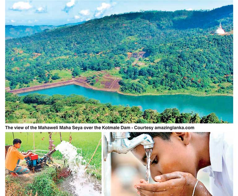
Sri Lanka’s Dry Zone is its agricultural heartland. Many centuries ago, foresighted engineers constructed dams, canals and reservoir networks, called cascades, to optimally manage water for agriculture and household use so that the inhospitable Dry Zone could be made liveable and cultivable. Such minor irrigation systems sustain the lives of some of the poorer farming communities – from Hambantota in the south up to Kilinochchi in the north.
These systems could withstand regular cycles of drought and flood that impacted the land. Flood damages could be met through public financing or projects as repaired infrastructure then had a longer lifespan. However, in the past decade or so, both flood and drought have intensified. Many years, months of deep drought have ended with flash floods with the north-east monsoon or inter-monsoon rains in October.
Consequent floods and drought impact all kinds of infrastructure, but reports show that small irrigation systems – commonly called minor irrigation/small tanks – are the worst impacted. Due to this extreme fluctuations of weather, with very few ‘normal’ seasons, small tanks have become breached, silted and unusable. Many such tanks are now abandoned, devastated by multiple disasters leaving farmers in these areas bereft of both irrigation and drinking water. In many so-called minor irrigation systems drinking water for household use is purchased from local businesses, as these tanks no longer are able retain water during the long dry season.
The Department of Agrarian Development shows that floods, and even drought, impacts small tanks much harder. For example, 982 small tanks were damaged in 2012 and 518 were damaged in 2014 floods. In the same years, drought impacted farmers of these systems, only hand of the cultivated area was used in the Yala season.
Can drought response also be effective against floods?
Small and large tanks were a traditional response to managing long dry periods of the Dry Zone. In effect, by capturing and storing rainwater that can be used during the dry season, these man-made lakes made it possible for farmers to cultivate water-intensive rice for two seasons. Water storage also improved recharge of ground water aquifers, so that water was available in wells even in dry periods.
However, if planned strategically and along a river basin, these systems can also mitigate downstream floods by capturing run-off. As such reservoirs and especially the multitude of small reservoirs which have been gifted to us by the foresight of our forefathers provide an ideal platform to management of both floods and drought situations in water scarce districts.
A river basin approach: Rethinking hydro-met disaster readiness
Except in the far north of the country, Sri Lanka is quite comprehensively covered by river basins. Both perennial and seasonal rivers supply water for cultivation, inland fishery, households and domestic use. Many irrigation reservoirs are lined up along the rivers and their sub-catchments, maximising capture and storage of water. However, river basins are managed by multiple agencies and a lack of coordination can result in unnecessary damage and destruction downstream.
For example, heavy upstream rainfall can result in irrigation reservoir sluices opening suddenly damaging small tanks and even villages in the down the river. Also, lack of rainfall in the upper catchments can result in hydrological drought in the plains. As flash floods and drought become increasingly common, it is imperative that disaster risk is assessed and managed along river basins, following scientific, hydrological boundaries to manage both disasters effectively. This is relevant to both dry, wet and the in-between or intermediate zone.
With the trend of increase uncertainty of weather patterns, possibly an outcome of rising global temperatures and climate change, risk reduction is essential. It is encouraging to see both the river basin approach and minor irrigation systems being the focus of a number of new projects and programmes lined up by the Government.
The World Bank’s CRIP or Climate Resilience Improvement Project implemented by the Ministry of Irrigation will map out nine river basins in its initial phase, with 10 more planned for the second phase. The project will provide details of specific vulnerable areas and at-risk communities along the river basin to enable effective disaster risk management and mitigation/early warning measures.
Funds from the Global Environmental Facility’s Special Climate Change Project (SCCF) have been invested by Ministry of Disaster Management in restoring a flood and drought damaged system of small tanks in the Kurunegala district in the Mee Oya river basin. This deviates from traditional ‘rehabilitation’ work by trying to incorporate new engineering solutions and restoring many of the traditional resilient features of the interconnected tank network or cascade.
Learning from this experience the UNDP (United Nations Development Programme) with the Ministry of Mahaweli Development and Environment plans to upscale this approach in three river basins in the northern and north central provinces through financing from the biggest global climate fund- the Green Climate Fund.
Taking a river basin approach is tough in a country with segregated and compartmentalised decision making. However scientific logic and the fact that the erratic nature of weather is only set to increase with climate change, dictates that investing in such a long-term approach may be the best solution to avoid increasing losses of crops, assets and lives.


