Monday Feb 23, 2026
Monday Feb 23, 2026
Wednesday, 18 May 2016 00:00 - - {{hitsCtrl.values.hits}}
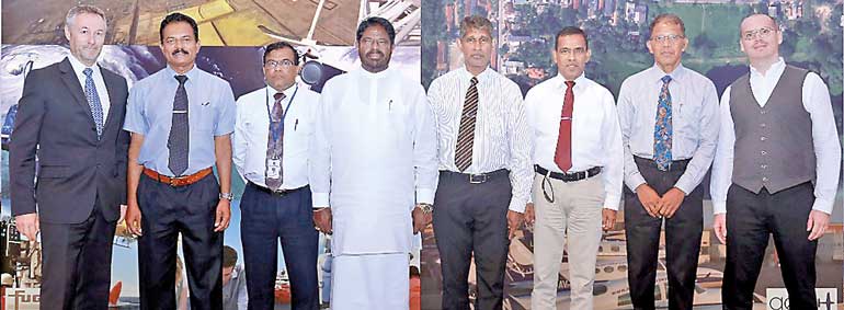 From left: Fugro Geoid SAS, Director Commercial Laurent Pronier, CRIP Project Director Eng. D.C.S. Elakanda, Ministry of Irrigation and Water Resources Management Secretary Eng. R.M.W. Ratnayake, Minister of Irrigation and Water Resources Management Vijith Vijithamuni Soysa, Surveyor General of Sri Lanka P.M.P. Udayakantha, Director General of Irrigation Eng. S.S.L. Weerasinghe, Civil Aviation Authority Director General H.M.C. Nimalsiri and Aerodata International Surveys BV International Sales and Business Development Manager Matthieu Lefebvre
One of the more critical stumbling blocks in Sri Lanka’s development journey are the climate-related hazards which pose a significant threat to the country’s economic and social progress.
Threats such as water scarcity, water excess, inter-seasonal variability of monsoons, droughts, decrease in energy security, increase in temperature, rising sea-levels and instability in agricultural production are some of the serious ripple effects which affect Sri Lanka and the South Asian region as a result of climate-related hazards.
There has never been a more urgent need for a comprehensive climate risk management programme to minimise economic losses and mitigate ensuing risk in order to make Sri Lanka resilient to these changes.
Funded by the World Bank, the Ministry of Irrigation’s Climate Resilience Improvement Project (CRIP) is a program aimed at implementing urgent disaster mitigation activities and to carry out a comprehensive study in 10 selected basins to mitigate the impact of floods and droughts. Since a high resolution Digital Elevation Model (DEM) is required for this purpose, LiDAR and Aerial Photography surveys on selected river basins were carried out.
The two contracts for Lidar surveying and the aerial photography surveying for the project were awarded to Fugro GEOID SAS and Aerodata Int. Surveys, respectively, both internationally established technological leaders in the field.
The two projects were recently presented to key stakeholders under the patronage of Minister of Irrigation and Water Resources Management Vijith Vijithamuni Soysa. Also present were Secretary of the Ministry of Irrigation and Water Resources Management Eng. R.M.W. Ratnayake, Project Director Eng. D.C.S. Elakanda, Surveyor General P.M.P. Udayakantha.
Aerodata International Surveys BV was represented by its International Sales and Business Development Manager M. Matthieu Lefebvre while Fugro Geoid SAS was represented by its Commercial Director M. Laurent Pronier.
Two key areas under the first component of the CRIP project are Lidar survey and an aerial photography survey, which will gather the necessary data required in order to determine the remedial action to be taken to improve the country’s resilience to climate-related challenges.
Lidar (Light Detection and Ranging) survey is a remote sensing method which uses light (LASER) to acquire data pertaining to the earth’s surface in a comprehensive, reliable manner. Fugro was founded in Netherlands in 1962 and employs over 12,000 people in over 70 countries. Fugro’s services span geotechnical, geo-consultancy, geo-science, surveying and subsea services. The present contract was awarded to specialised subsidiary Fugro Geoid SAS to undertake Lidar survey for the CRIP project in Sri Lanka.
The data extrapolated specifically through Lidar survey conducted will include terrain models, geographical databases, maps and geographical information systems which will add decision making, infrastructure planning and population protection in the future. Having worked with projects and clients from varying sectors across the world and with decades of experience, Fugro Geoid SAS possesses the expertise to bring the highest expertise, operational support and the best of technology, even in the most challenging conditions.
A leading airborne surveying and mapping company with 24 years of experience, Aerodata Int. Surveys specialises in airborne spatial data acquisition around the globe through cutting edge technologies and advanced processing. With five offices around the world, a workforce of highly talented professionals and a large fleet of 10 aircrafts to suit the field needs and unique purposes of varied projects, Aerodata Int. Surveys takes an innovative and interactive approach with its work and in the processing of value added geo-information products.
Through the geo-spatial information yielded by aerial photography surveying, Sri Lanka joins the long list of countries to make use of the technology which captures geo-data with high accuracy, quality and resolution. In additional to data acquisition, Aerodata’s strengths lie in its ability to carry out high demanding and advanced data processing to suit geo-spatial projects and provide value added information to aid decision making, beyond primary data.


